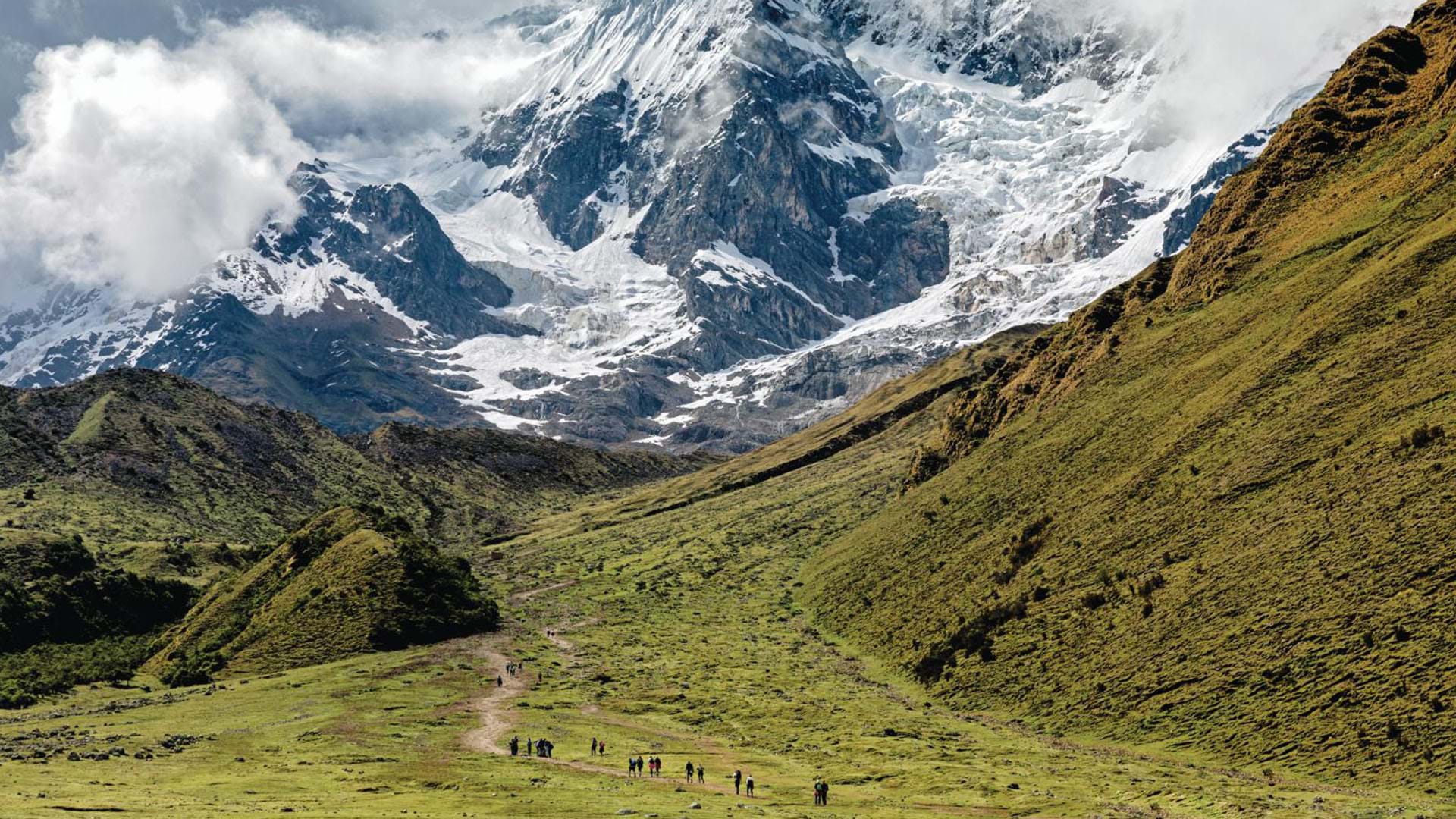
Located in Santa Teresa, one of the twenty districts of the Cusco province of La Convencion, this archaeological complex is considered the second most notable in Cusco after Machu Picchu for its design and construction characteristics and whose name in Quechua means “Cradle of Gold.” . It is located 3,048 meters above sea level, in the foothills of the snow-capped Salcantay , north of the Apurimac River valley, in the Vilcanota mountain range.
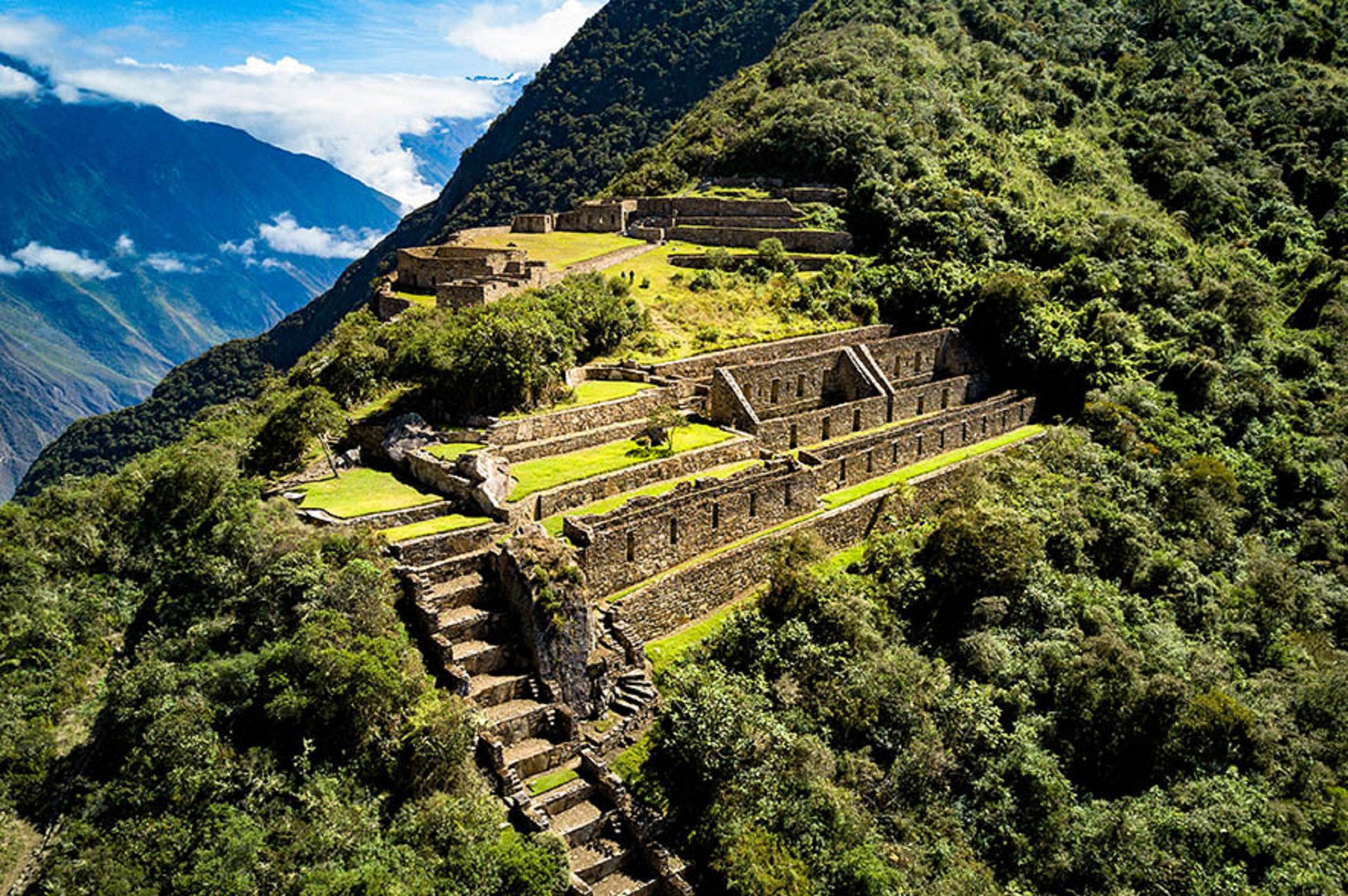
This citadel extends across three hills and so far 12 sectors have been identified. Archaeological investigations estimate that more buildings still need to be discovered, given that only 30% of its entire area has been excavated.
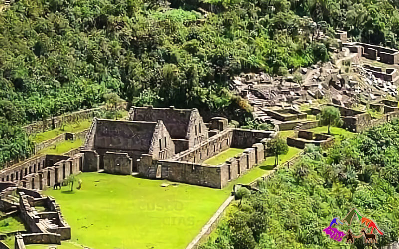
In the city, the ceremonial center stands out, which is a large platform that is accessed through a double-frame door. Likewise, there are two main squares, temples, water fountains, canals, workshops, warehouses, elite residences and other properties that seem to have had an administrative use.
Another of the impressive structures of Choquequirao is a huge staircase that at dawn on the summer solstice is completely illuminated by the sun’s rays. Although all the buildings are made of stone, some of them were covered with clay both inside and outside, which is why they exhibit a light orange color.
Choquequirao presents multiple two-story buildings with niches inside. In addition to some doors and niches made with double jambs and irrigation channels. The material that was used is stones joined with clay mortars.
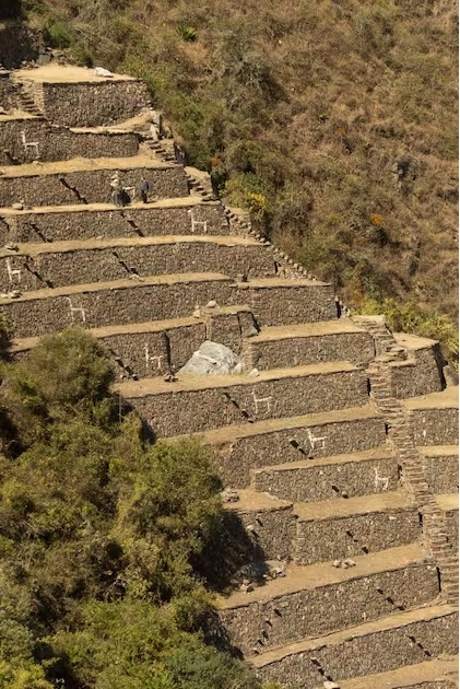
There are 22 images on these stones with figures known as “Flames of the Sun”, arranged on 15 platforms towards the snowy Quory. Hauyrachina . Choquequirao has a large system of platforms, a characteristic of Inca constructions, which helped in the agricultural use of the hillsides, and which currently, to the eyes of visitors, look like floors carpeted in green by the vegetation of the zone.
How to get to Choquequirao
Tourists who visit Choquequirao usually do so along the route that starts from Cusco to kilometer 154 of the highway to Abancay. Next, you take a detour that leads to Cachora, one of the nine districts of the province of Abancay, in the department of Apurímac.
Then, you ascend with a zigzagging uphill walk of about 28 kilometers to the archaeological park of Choquequirao . To return you take the same path.
Another route to get to Choquequirao consists of starting from the city of Abancay and traveling until kilometer 42 of the highway towards Cusco and then taking the detour to Cachora. In order to alleviate the trip and the possible ravages of altitude, there is the service of porters and rental of mules to carry luggage.
To experience a safe trip, it is advisable to hire the services of an expert tour guide who knows well how to get to Choquequirao , considered one of the best hiking routes in southern Peru.
Tourism development project
With the aim of reducing travel time and increasing the number of visitors to Choquequirao , which is currently around 8,000 a year on average, the Ministry of Foreign Trade and Tourism (Mincetur) promotes a tourism development project.
JK Travel & Exhibition, is a tourist enterprise that offerd specials tours and services .